Somerset · TA1-TA4
Drone search and rescue cover in Taunton
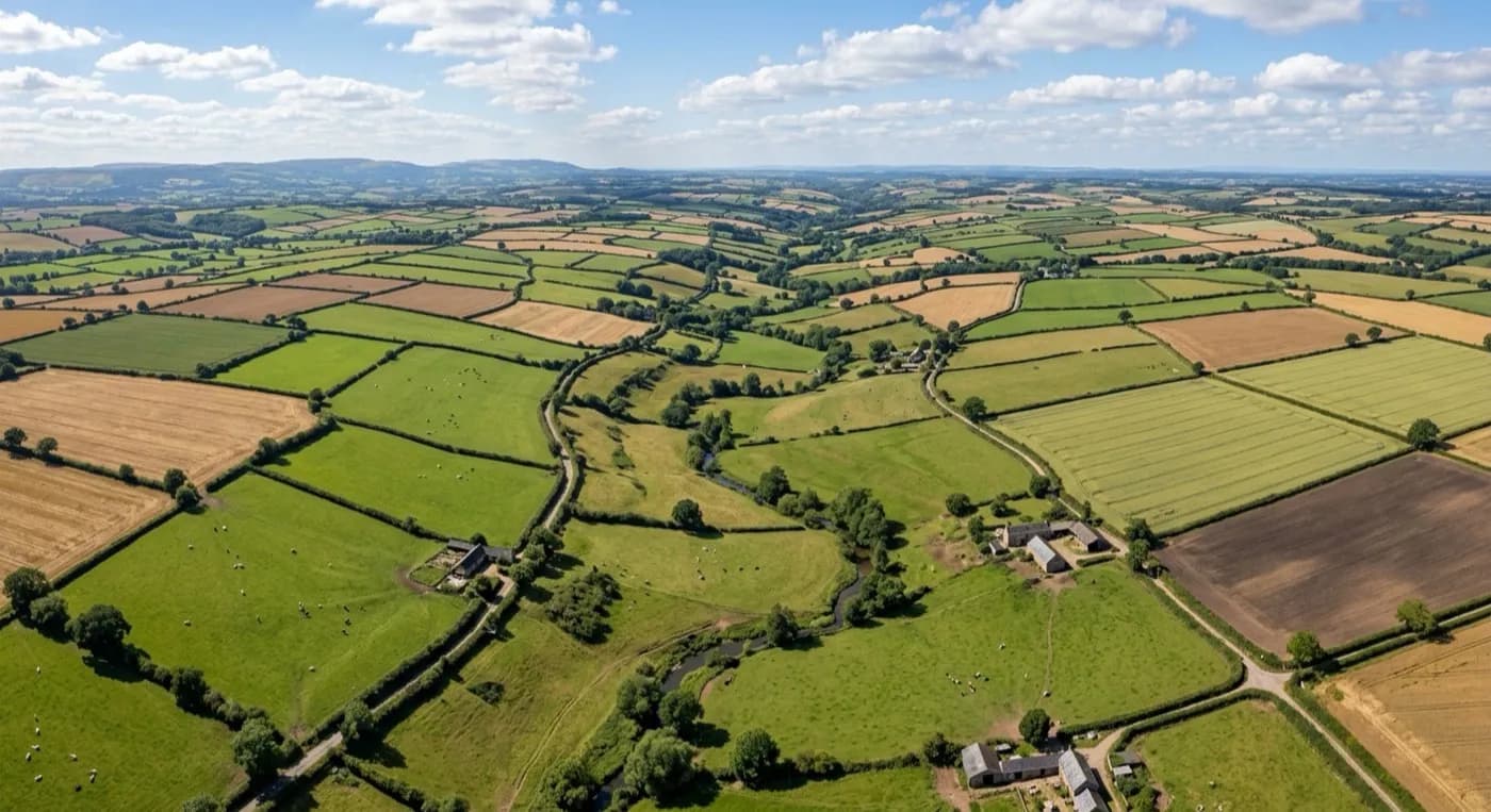
Aerial search cover across the large hedged fields and fog-prone vale farmland around Taunton, in the Somerset lowlands.
Flat ground with a lot of it to check
The vale around Taunton looks straightforward on a map: flat, farmed, with the Tone running through the middle of town. On the ground it's less simple than it looks, because the fields are large and hedged, and a hedge line or a dip within a field blocks a clear view from the road or from a neighbouring gate. Someone, or a strayed animal, can sit within a single large field and stay out of sight of anyone walking the boundary.
Covering that same run of fields by air takes a fraction of the time a foot search would need, because the aircraft isn't stopped by a hedge the way a person is. The visual camera picks out colour and shape against open pasture or stubble, and a coordinator directing the search can be shown, field by field, exactly which ground has already been covered and which hasn't.
For a family searching privately, or a search coordinator managing several volunteers across a wide area, that field-by-field record matters as much as the coverage itself, because it stops effort being duplicated on ground that's already been checked while other fields sit untouched.
Fog that holds in the vale
Taunton sits low, ringed by the Quantocks, Blackdowns and Brendon Hills, and while that ring of hills keeps the vale generally drier than Devon, it also traps fog and frost on the valley floor. A morning fog here can sit for hours after it's lifted on higher ground nearby, cutting visibility for ground teams and for vehicles moving between search areas.
The hills around the vale also throw localised gusting when weather turns unsettled, even while the town itself feels calm. A pilot checks conditions on each side of the vale rather than trusting a single reading from the centre, and flight windows are chosen around that, which often means work can continue near Taunton even when the wider forecast for Somerset looks unpromising.
Strayed livestock across vale farmland
Vale farmland like this is exactly where livestock searches tend to happen: large hedged fields, gates left open or fences down, and animals able to travel a surprising distance before anyone notices they're missing. Walking every boundary on a farm this size can take most of a day; a flight over the same fields, checking for animals grouped in a corner, under trees or along a hedge line, is a much quicker way to narrow down where to look.
Vivary Park, Taunton Castle and the County Cricket Ground all sit close to the centre and give a coordinator or an unfamiliar family a fixed point to work from when describing where a search sector starts, with the live video feed then filling in the detail of the actual ground.
Behind the flight
What sits behind a search around Taunton
CAA registered
Operator ID and Flyer ID held, plus the A2 Certificate of Competency. Paperwork is available on the phone before a flight, including to the police or a search coordinator if it is needed.
Radiometric thermal
A DJI Mavic 2 Enterprise Advanced carrying a 640 by 512 thermal camera, strongest at dawn, dusk and after dark, which is when a ground search slows down the most.
100 megapixel visual camera
A DJI Mavic 4 Pro with a Hasselblad camera and 6K video, used for daylight coverage and for legible imagery of anything found, close enough to act on.
Insured with Coverdrone
Full commercial cover for the operation. Certificates go to a search coordinator, a landowner or an event organiser as a matter of course, without anyone having to chase for them.
Nearby
Also covered around Taunton
- WellingtonAerial search cover from the open Blackdown escarpment down to the sheltered Tone valley around Wellington.
- BridgwaterAerial search cover across the cut ditches and reed beds of the Somerset Levels around Bridgwater, ground that is slow going on foot.
- ChardAerial search cover across the exposed ridge-top farmland around Chard, the highest town in Somerset.
- MineheadAerial search cover from the steep bracken slopes behind Minehead down to its harbour, on Exmoor's northern edge above the Bristol Channel.
See how a search is flown
Call now, same day in Taunton
Call with the location and what has happened. Sam Hembury will come back with a fixed price and get airborne as soon as it is safe to.